 Admin
Admin
From Swabia to the Baltic: Student Engineers dive into Marine Technology at north.io
Kiel, Germany. This week, north.io had the pleasure of welcoming a group of eleven highly motivated students from Esslingen University of Applied...
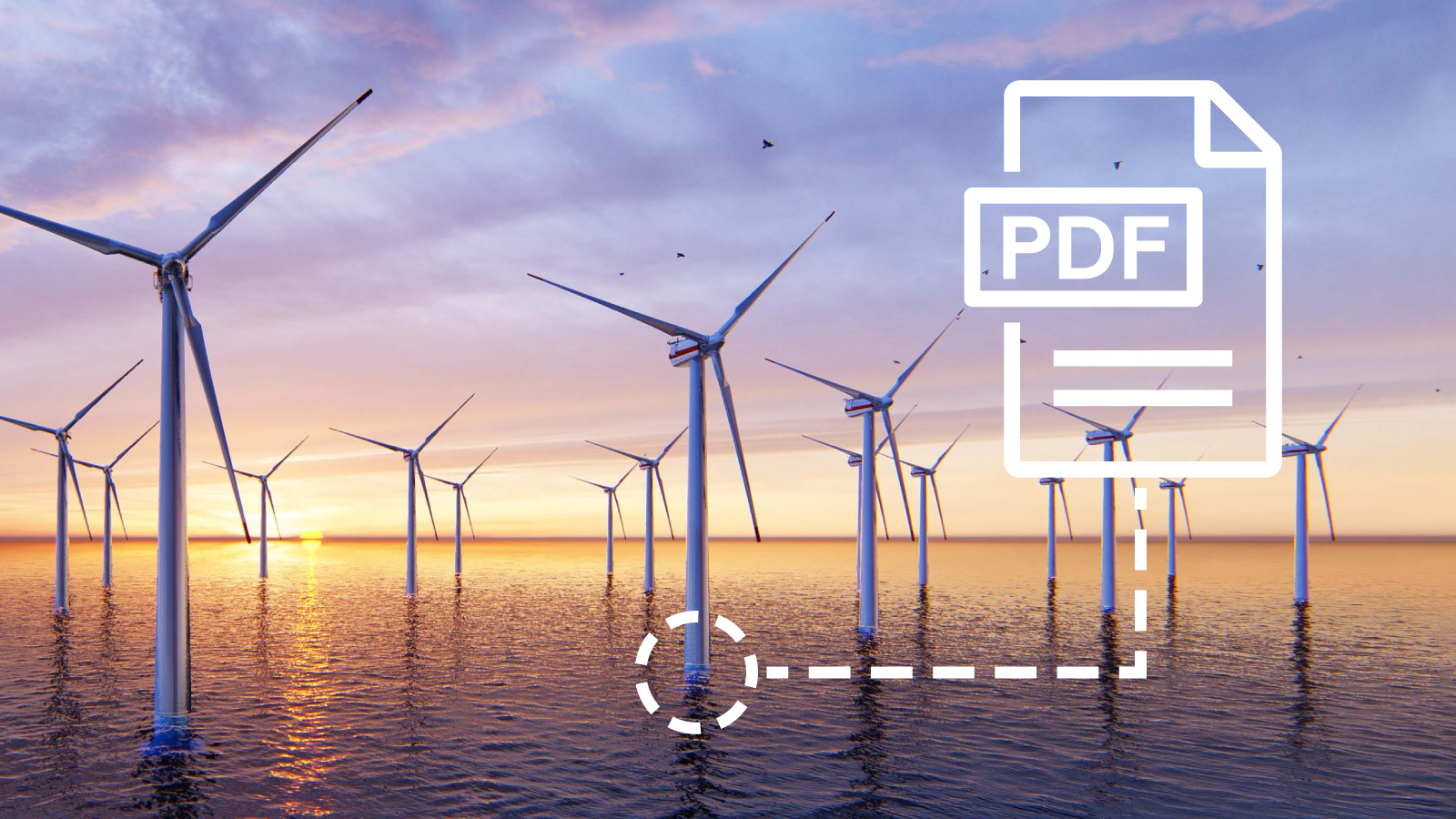
We’re excited to announce our latest innovative feature on all north.io data platforms: Geotagging.
In today’s digital landscape, data is everywhere, but finding the right data, especially when it lacks spatial reference, consumes time and slows down processes as well as workflows. With Geotagging, we are turning file search on its head through providing spatial references to files like images, reports, videos, and spreadsheets using precise locations. This means easy access, better collaboration, and faster insights for your teams at sea and in the office.
Spatial data like shapefiles, rasters, or point clouds come with inherent spatial references. We are used to viewing them on maps and working within a spatial context. Unfortunately, the vast majority of project-relevant files do not natively allow us to set a spatial reference (although most information we process is in some way or another linked to a location on our earth). Examples for project relevant files are:
These non-spatial files are essential yet disconnected from the geospatial context that provides meaning. Our new Geotagging feature closes that gap. With just a few clicks, you can assign precise spatial references to these files using points, lines, and polygons. Even better: each file can have multiple geometries, letting you represent its full spatial reality. 
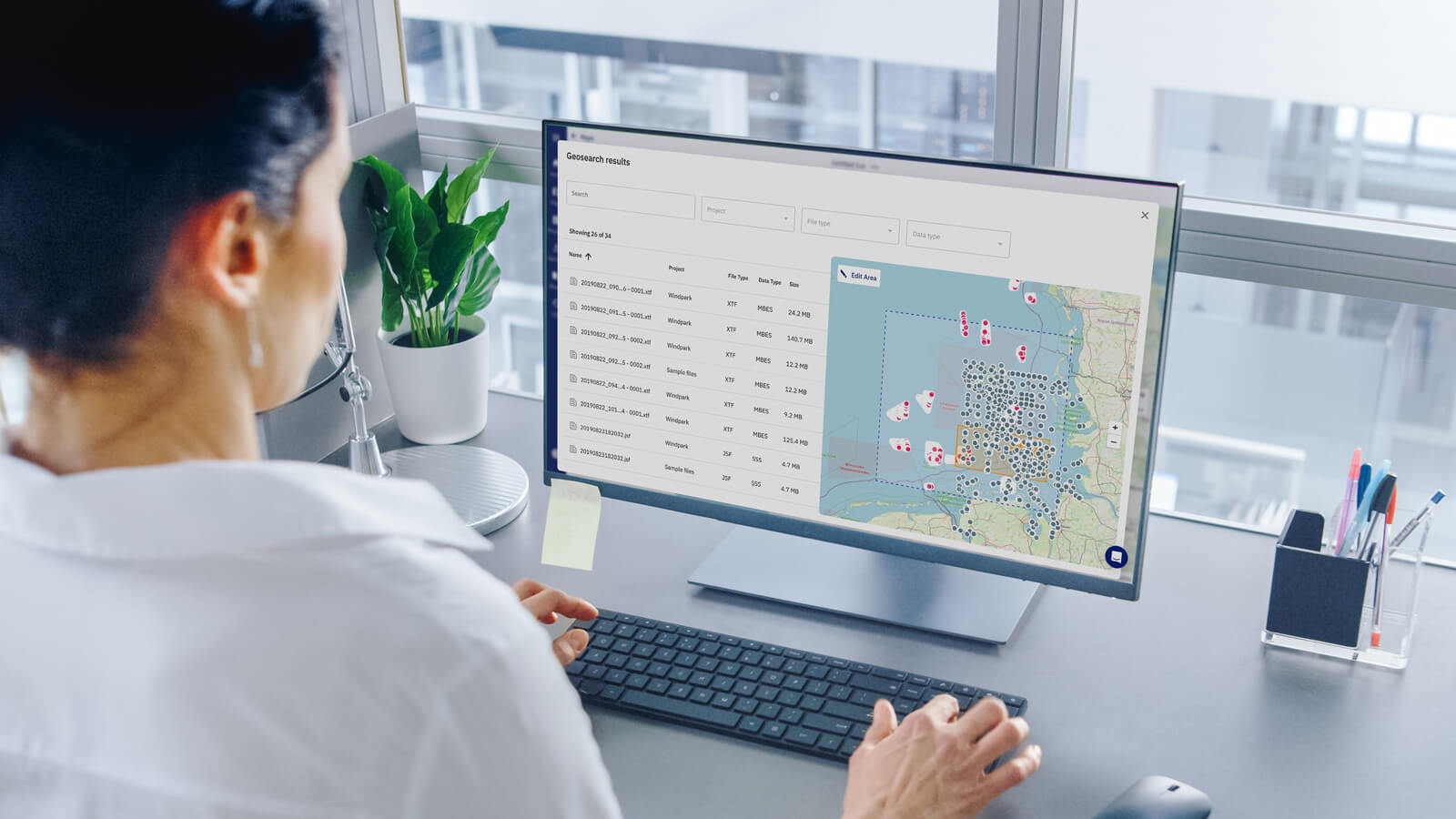
Geotagging unlocks a powerful upgrade to one of our platform’s most used capabilities: the geospatial search called GeoSearch (https://news.north.io/en/digital-maps-unveiling-north.io-mapping-capabilities). After having transformed your non-spatial files into spatially referenced files using Geotags, you can forget about searching by file or folder name and start searching by locations.
You can select any area of interest on the map and instantly retrieve all associated data within your workspace. No more diving into directories, second-guessing naming conventions, or missing key insights buried in the wrong folder, or worse hidden on the hard drive in your colleague's cupboard.

Consider the example of a data manager at a major offshore wind development company. As the engineering team prepares a pre-assessment for a new development zone, time is short, and clarity is essential. Leveraging the combined power of Geotagging and GeoSearch, the data manager simply selects the area of interest on the map. Instantly, all relevant datasets are retrieved, both spatial files like sensor or bathymetry data, as well as borehole and environmental assessment reports or ROV footage (MP4). Within seconds, the manager can compile and share all necessary information with the engineering team, dramatically speeding up the decision-making process and enabling seamless, location-driven collaboration. Knowing what data is available is invaluable knowledge to plan survey tenders and make high stake decisions on offshore operation and maintenance. 
Geotagging empowers your team to shift their focus from file hunting to data insights. Experts estimate that 60 to 80% of analysts and scientists' time is spent on data discovery, cleaning, and preparation [1]. This is time not spent analyzing the data and generating actionable insights. Instead of navigating through endless folders and unclear file names, data managers can now visually manage and find non-spatial content directly on the map. By creating spatial references across all file types, whether it’s a PDF report, an image, or a video, they ensure that every stakeholder receives the data they need when they need it. Introducing Geotagging isn’t just a feature upgrade- this is another strategic move toward harnessing geointelligence and transforming the way we work with data.
Geotagging is available now for all north.io platform users. Try it out and experience how spatially enriched content can transform your data workflows.
If you want to discuss how using Geotagging can streamline your data management, reach out to:
sales@north.io
[1] https://solutionsreview.com/data-integration/youre-spending-way-too-much-time-on-data-preparation/
.jpg)
Kiel, Germany. This week, north.io had the pleasure of welcoming a group of eleven highly motivated students from Esslingen University of Applied...
.png)
Lisbon/Kiel. The TrueOcean data platform from German cloud-geospatial-data-specialist north.io has been officially selected to participate in the ...
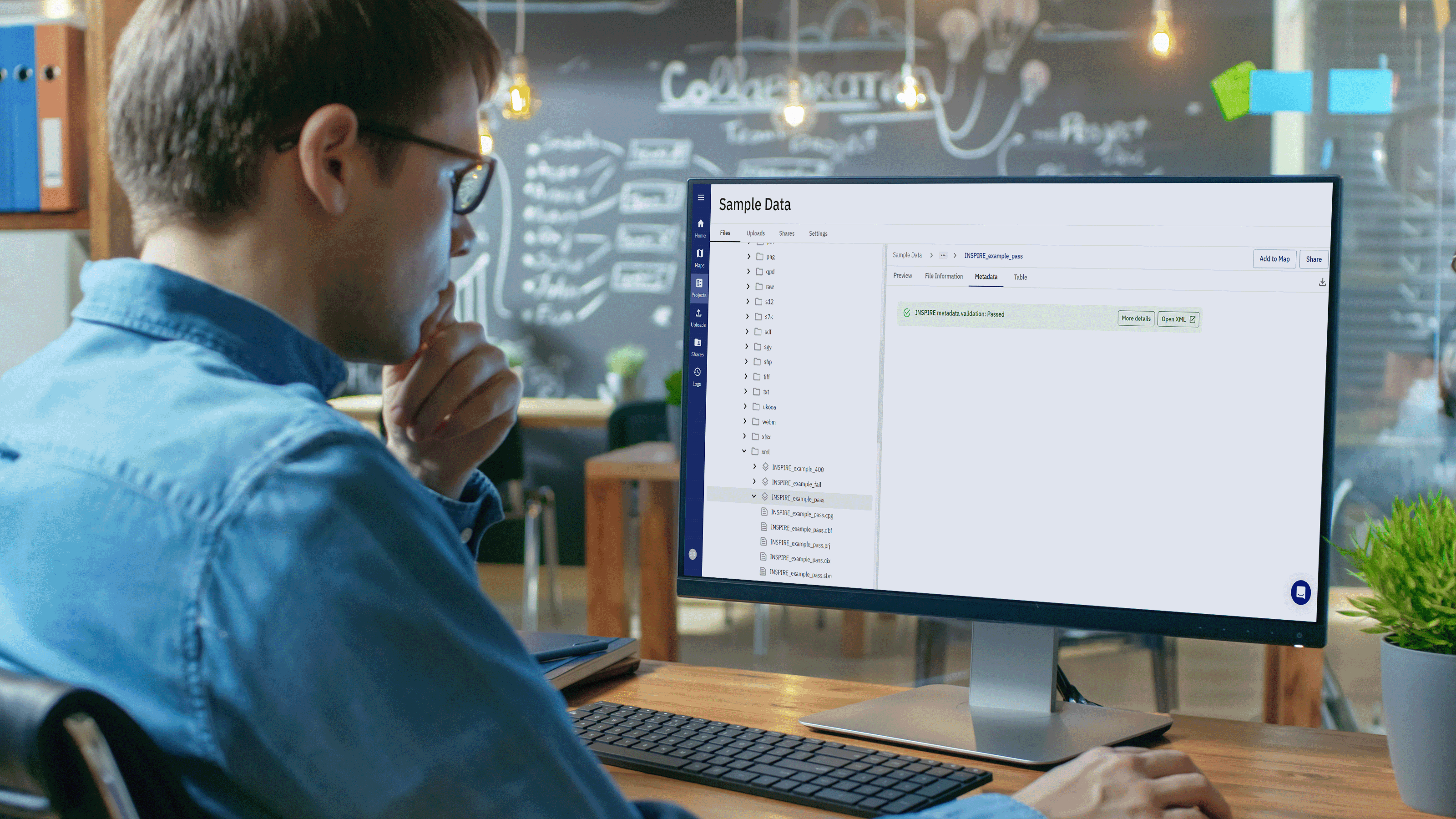
Background In the realm of geospatial data, metadata plays a pivotal role in ensuring the integrity, usability, and accessibility of information....
In today's fast-paced ocean industry, the ability to efficiently manage and locate hydrographic survey and underwater inspection data is crucial. The...