 Admin
Admin
Geospatial Data Management with north.io
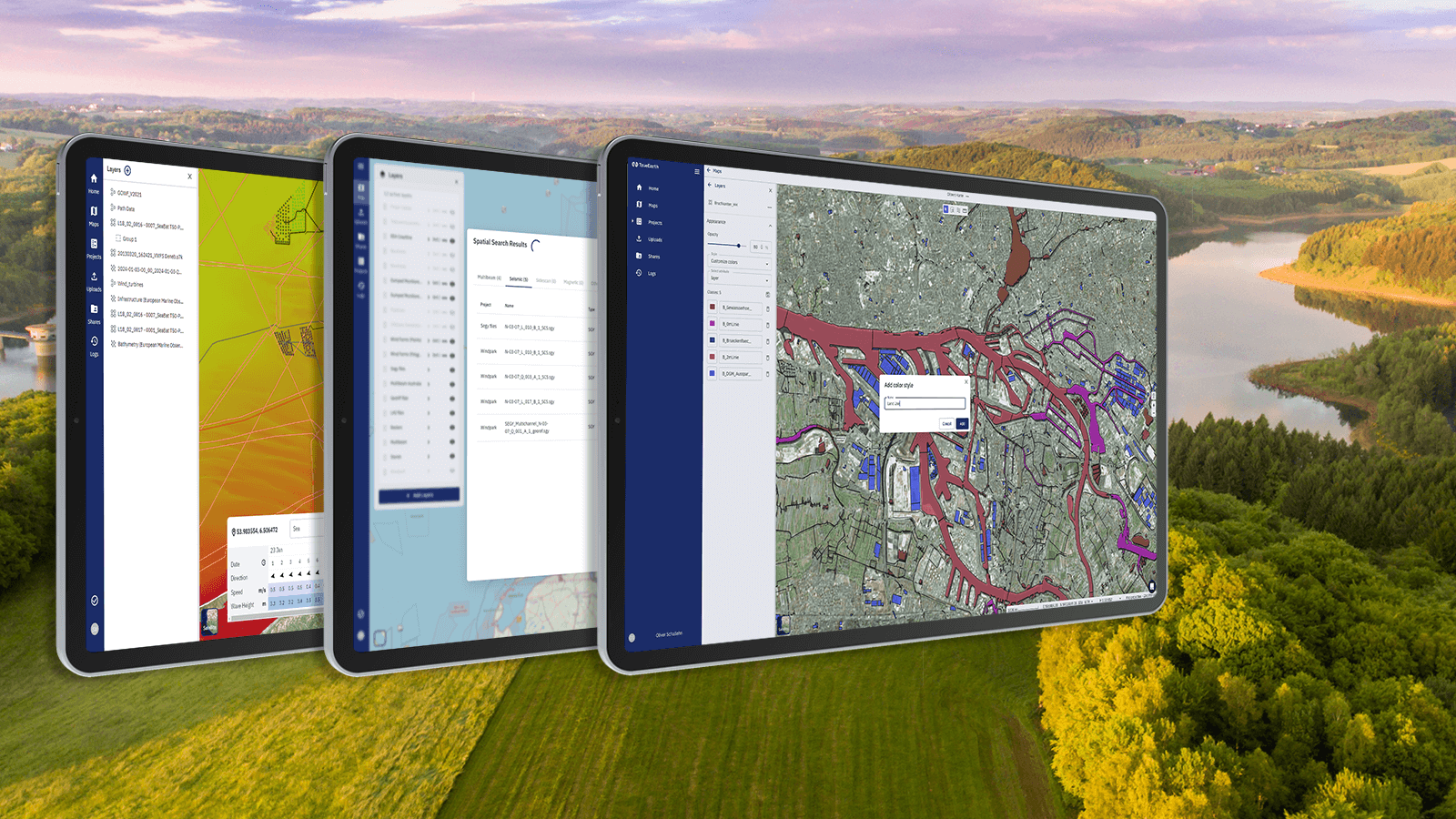
In the geoinformation sector, the demand for intuitive, cloud-based solutions has surged. The ability to craft appealing digital maps with ease and efficiency is an essential tool to visualise data and inform stakeholders. Enter our latest development: a geospatial data hub with intuitive digital map functionalities that empower users to create and share maps effortlessly. Let's delve into the innovative features that set our self-service software apart from traditional geographic information systems (GIS).
Accessibility and Scalability
One of the most evident advantages of our cloud-based geospatial data hub is the new level of accessibility. Unlike desktop-based software, users of our web-based cloud software can access, edit, and collaborate on maps from anywhere, at any time, directly within their browser. Say goodbye to the constraints of specific operating systems or costly hardware requirements. Whether you're on a powerful workstation or working remotely on your notebook, the cloud-based nature of our platform ensures seamless access to your maps.
Besides offering accessibility through design, we aim to make geodata itself more accessible and findable. If you’re interested in learning more about our ground-breaking geosearch, feel free to read how we introduced a smart geospatial search.
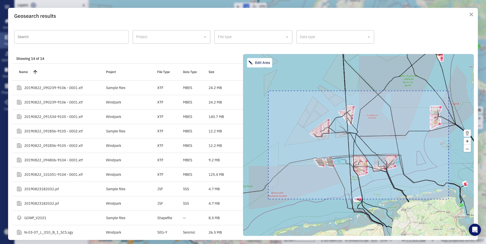
Image: Geospatial search feature on TrueOcean Marine Data Platform
Scalability is another important factor for us. Whether you need more storage to manage your geodata or want to invite more people to collaborate through maps, the cloud-based nature of our platform allows for an effortless scaling up of your processes. Our platform technology dynamically adjusts to your needs, ensuring optimal performance without the headache of infrastructure management. Focus on what really matters: your geodata!
Our Secrets: Simplicity and User Friendliness
The essence of our technology is the underlying, highly scalable geodata management system that takes the organisation and collaboration of data to an unprecedented level. Data organisation and especially user interfaces of traditional GIS software often present a steep learning curve, putting off non-experts, beginners, and sometimes even seasoned professionals. In contrast, our geospatial data hub boasts an intuitive, user-friendly interface designed to simplify complex mapping processes. We stripped down classic and overcomplex GIS systems to the most essential features and will further develop advanced functionality in collaboration with our users, based on what they need to excel in their processes. By offering an interface that's both powerful and straightforward, we bridge the gap between novice users and GIS professionals. Our goal is to empower everyone to craft maps effortlessly and understand even their complex and large-scale geodata.
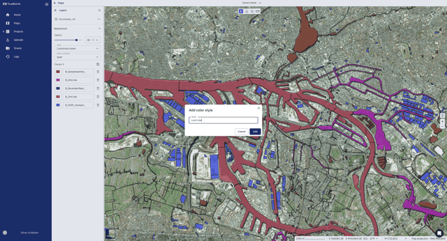
Image: Dynamic layer styling shown on TrueEarth platform's map.
One central user experience improvement lies with seamless layer styling. Veteran GIS users will remember how tedious it was to style each layer individually, save or apply the edits, and then go on to repeat the same routine on all layers of interest. Instead, we offer dynamic layer styling where edits like the colour fill or colour ranges based on classified groups are displayed on the fly. Without leaving the appearance settings, the user can switch between layers and change layer styling seamlessly.
Collaboration and Real-Time Updates
Collaboration lies at the heart of our cloud-based solution. Unlike traditional software, our geospatial data hub fosters real-time collaboration among team members. Whether you're working on a local project or collaborating with a global team, our solution ensures seamless sharing, editing, and updating of maps.
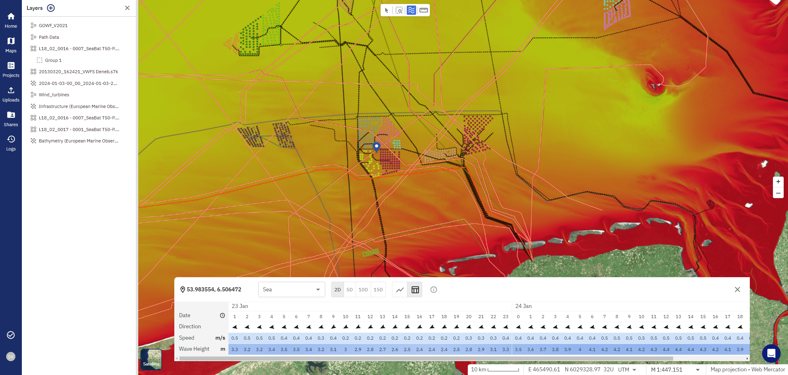
Image: Weather insights shown on TrueOcean MDP's map.
Moreover, the ability to incorporate real-time data updates in modular ways sets us apart. Maps need to reflect the latest information. In partnership with large-scale data providers, we offer our customers access to the latest weather data, for every place around the globe. With one click, you can for example retrieve the latest data on wind speed and wave height to enrich your maps for potential wind farm projects.
Conclusion
In conclusion, our cloud-based geospatial data hub stands as a beacon of innovation, offering unparalleled advantages over traditional GIS software. With accessibility from anywhere, an intuitive interface, and real-time collaboration capabilities our platform is revolutionising map styling and creation.
We invite you to experience the transformative power of our geospatial data hub first-hand. Schedule a demo to explore how our platform can elevate your mapping and geodata workflows. Join us in reshaping the landscape of geospatial technology - one custom digital map at a time.
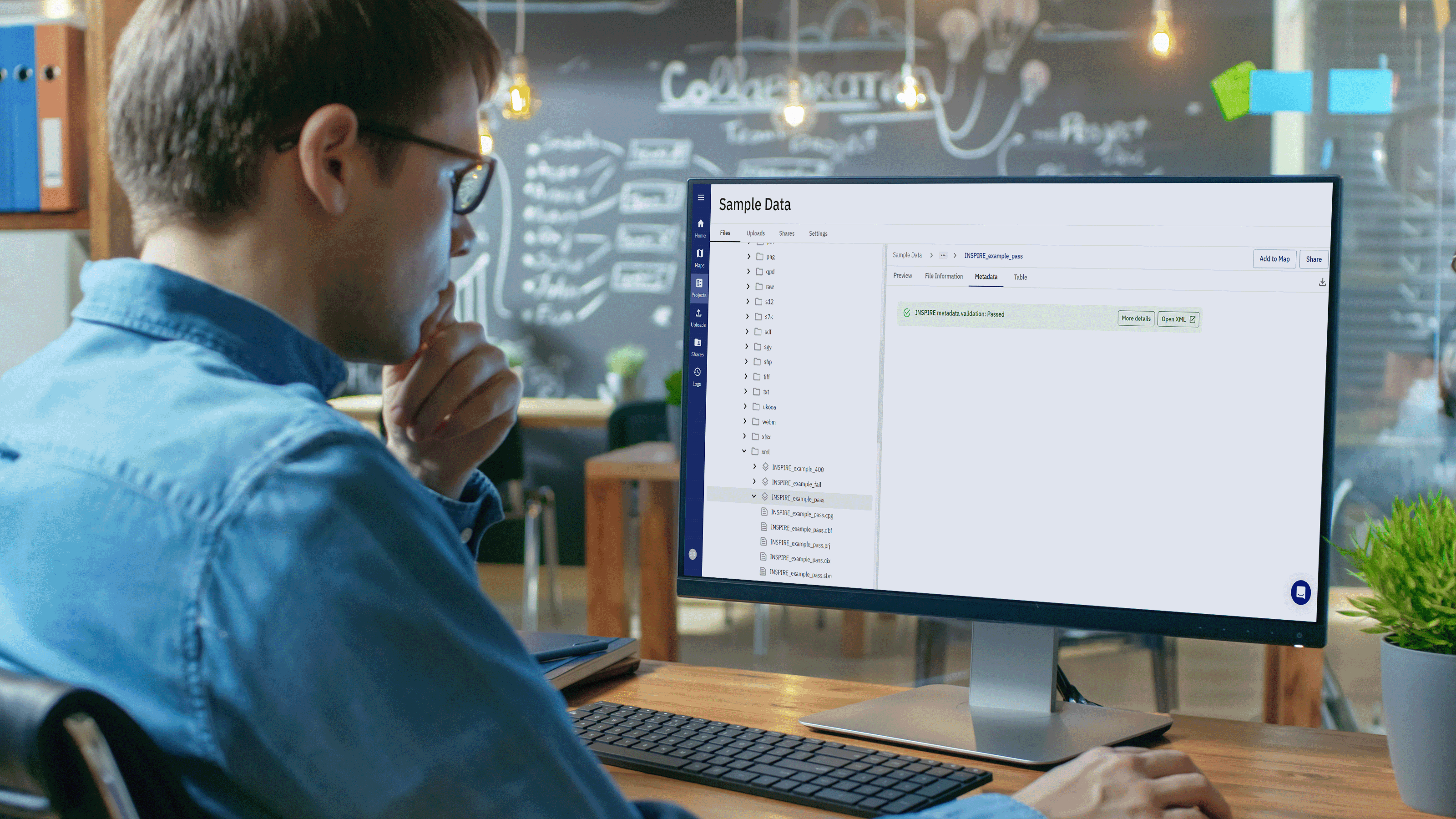
north.io Elevates Geospatial Data with ISO 19115 Metadata Validation
Background In the realm of geospatial data, metadata plays a pivotal role in ensuring the integrity, usability, and accessibility of information....
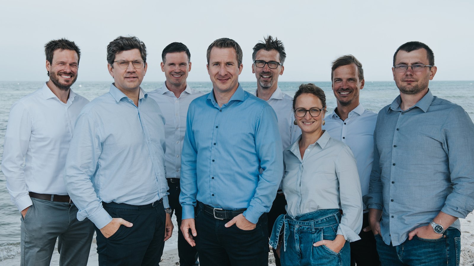
TrueOcean and north.io merge to become a leading Cloud Geodata Specialist
Kiel, 18.09.2023. The merger of three Kiel-based software companies, north.io GmbH, TrueOcean GmbH, and NatureConnect GmbH, marks a significant step...
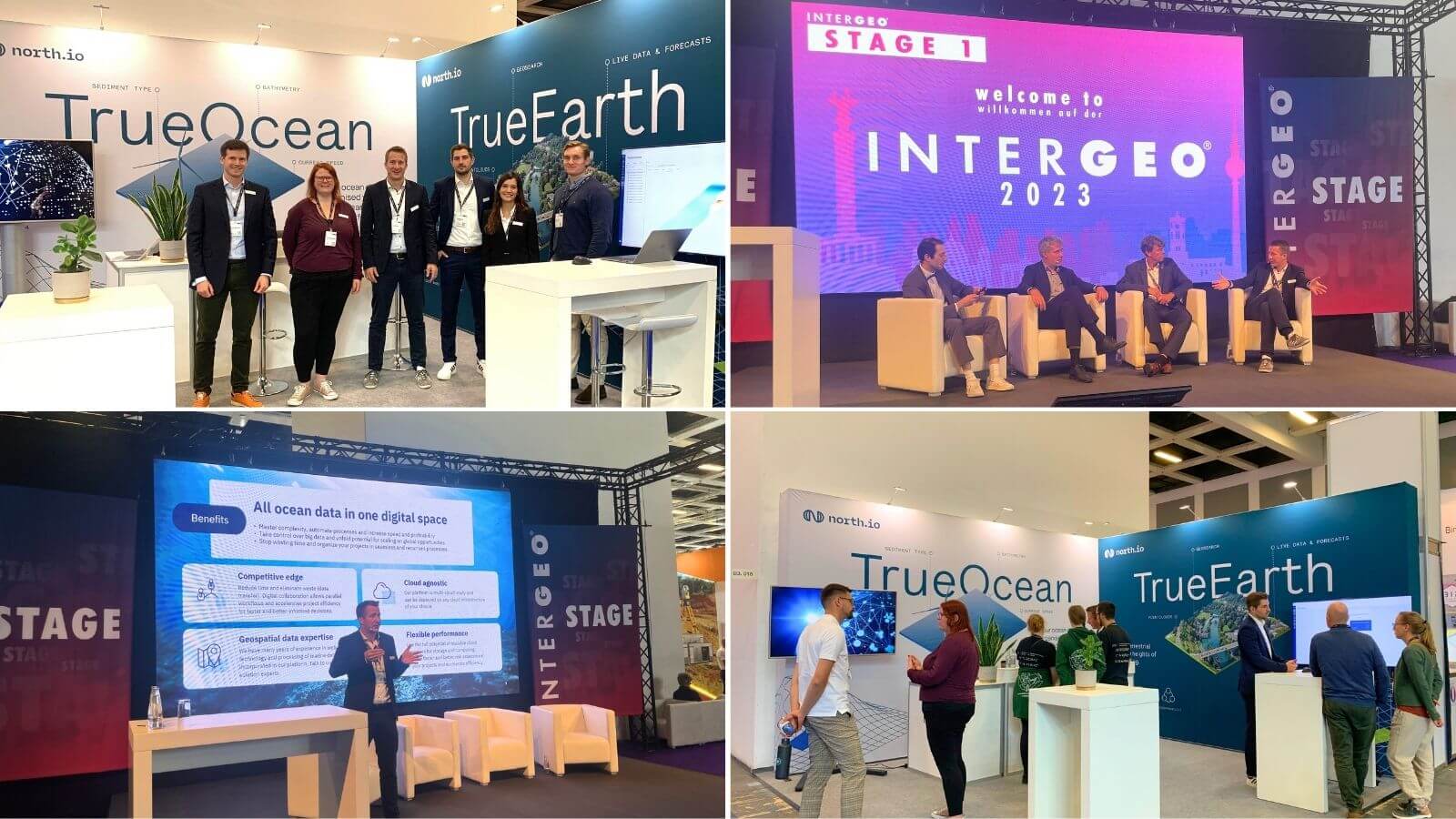
Cloud Geodata Specialist north.io shines at INTERGEO 2023
Berlin /Kiel 16.10.2023 Last week north.io exhibited at INTERGEO 2023, the world's leading exhibition and conference for geodesy, geoinformation,...