north.io Closes 8.5 Mio. Seed Investment Round led by VAERING: Lifting Ocean Data into the Cloud
Kiel / Hamburg – VAERING, the Hamburg-based family office, has officially joined north.io as the lead investor in their EUR 8.5 mill. seed...
3 min read
.png)
Lisbon/Kiel. The TrueOcean data platform from German cloud-geospatial-data-specialist north.io has been officially selected to participate in the IHSensortech BlueTech initiative of the Instituto Hidrográfico (IH) of the Portuguese Navy. This selection, announced on July 25, 2024, is part of the "Hydrographic Data Consolidation Software Development" challenge. This challenge aims to develop an application for integrating geographic information that can process and determine which information takes precedence based on a set of user-defined constraints. In total, this open innovation edition drives maritime innovation across five areas, aiming to address real-world innovation challenges through pilot projects and collaborations. More information can be found here: (https://bluetechaccelerator.com/instituto-hidrografico/).
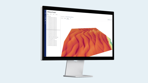
Visualisation of sensor data in the TrueOcean data platform
This program, a cornerstone of the Hydrographic Institute's innovation strategy, will be carried out in collaboration with the Portugal Blue Digital Hub. This Hub aims to foster the development of cutting-edge technologies that can revolutionize the processing and utilization of hydrographic data.
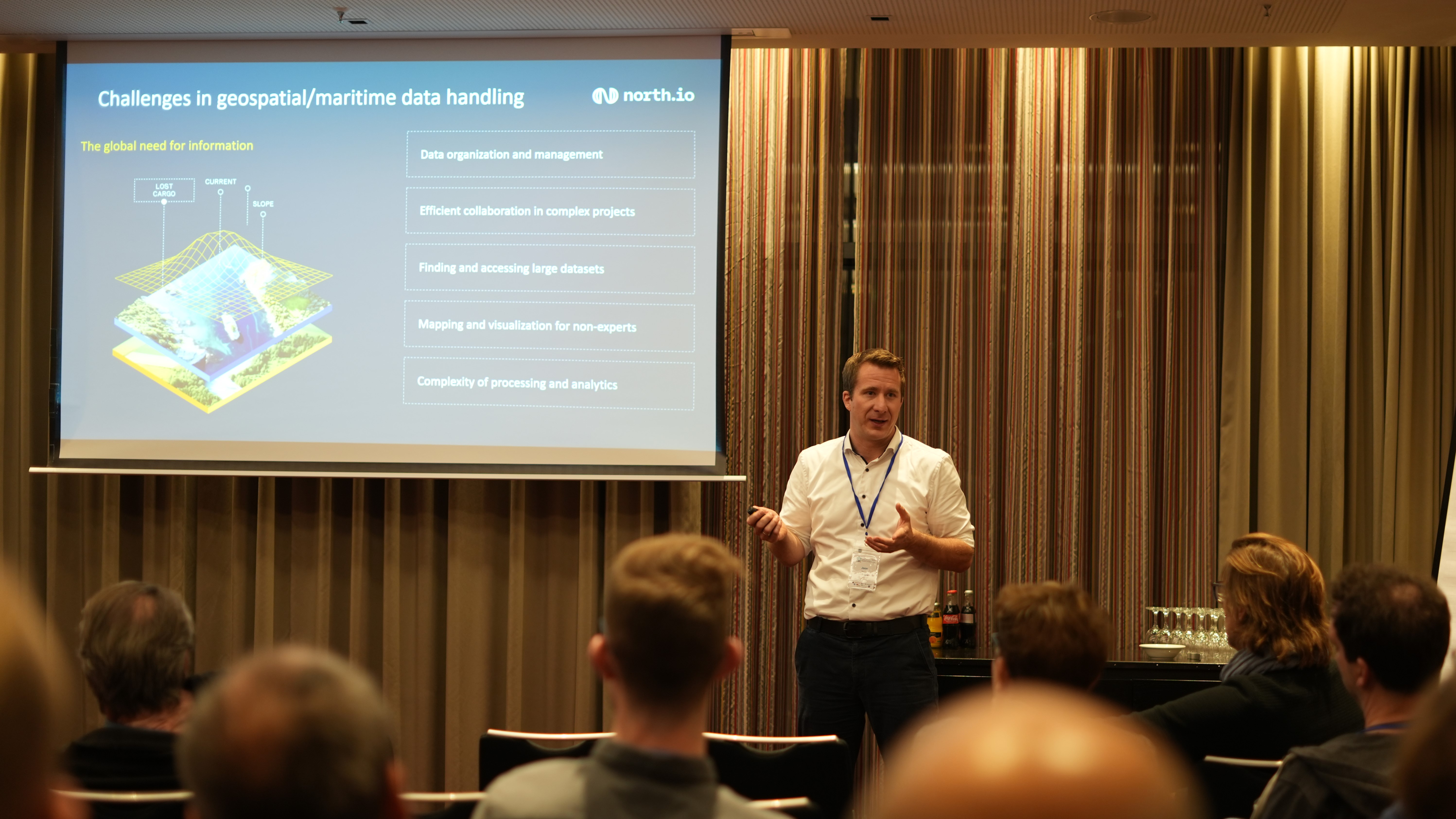
Jann Wendt, CEO of north.io, expressed his excitement about the selection:
"This prestigious program, led by the Instituto Hidrográfico of the Portuguese Navy and initiated by the Portugal Blue Digital Hub, provides us with a unique opportunity to conduct a funded pilot of our cutting-edge ocean data platform in real-world marine environments. Our platform addresses key challenges in ocean data management and offers advanced features for data integration, accessibility, and visualization."
The selection of the Kiel-based specialist underscores the global recognition of north.io's expertise in ocean data management, particularly in offshore wind and critical marine infrastructure. It also highlights the collaborative spirit of the IHSensortech BlueTech program, which brings together leading experts from across Europe to tackle pressing marine challenges, evaluate technologies, and stay on top of market trends.
"Our entire team is looking forward to working with the Instituto Hidrográfico to refine our solutions to meet their specific needs and set new standards in the field of ocean data management",
adds Wendt with a smile.
Additionally, north.io’s involvement in this project complements their work on Project “Argus”, funded by the German Ministry for Digital and Transport. This initiative, titled "Automated Recognition of Ghost Ships and Underwater Surveillance" (Argus), focuses on the protection of critical underwater infrastructure (CUI). With a grant of 2.7 million euros, the project aims to develop an advanced data management platform that integrates cloud technology, geoinformatics, and artificial intelligence to systematically monitor and protect underwater assets.
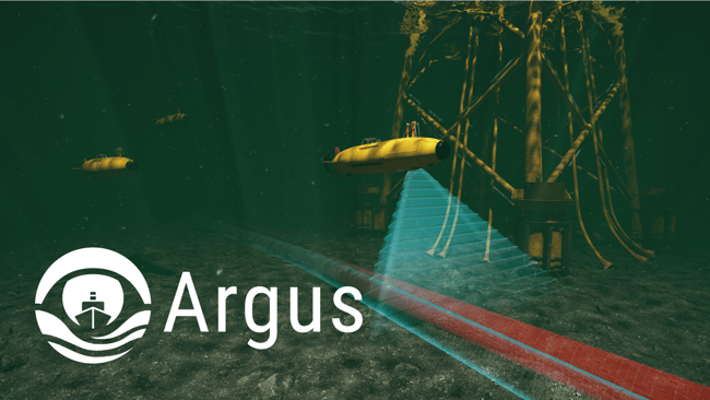
The Argus project addresses the challenges posed by "ghost ships"—vessels that deliberately conceal their position—and aims to provide real-time data analysis for underwater infrastructure. Collaborating with the GEOMAR-Helmholtz Centre for Ocean Research Kiel and Subsea Europe Services GmbH, north.io is set to transform how geodata is utilized for security and decision-making, ultimately enhancing Germany's capacity to safeguard critical maritime infrastructure.
The Instituto Hidrográfico, an integral part of the Portuguese Navy, is responsible for hydrographic surveys, nautical charting, and oceanographic research. As a key maritime service, it plays a crucial role within NATO, contributing to the alliance's collective maritime security and defense strategies. The Instituto provides vital data and expertise that support both national and NATO operations, ensuring safe navigation and effective maritime defense. Its collaboration with programs like IHSensortech BlueTech underscores its commitment to advancing marine technology and enhancing maritime safety on an international scale.
The IHSensortech BlueTech Program is an initiative led by the Instituto Hidrográfico aimed at fostering innovation in marine sensor technologies and data management. The program is designed to address current challenges in marine data collection, processing, and analysis by supporting the development and implementation of advanced technologies. By partnering with leading technology firms and research institutions across Europe, the IHSensortech BlueTech Program seeks to enhance the capabilities of hydrographic and oceanographic data systems, ultimately contributing to improved maritime safety, environmental monitoring, and strategic defense operations. The program’s collaborative nature and focus on cutting-edge solutions position it as a critical component in the modernization of maritime operations within NATO and beyond.
Timeline and next Steps
In an online pitching session on July 23rd, the selected companies from the open application defended their case: north.io showcased all the key features of its product, how it works, and defined TrueOcean's unique value proposition.
The next phase will be a so-called Co-Design Sprint from October 14th to 18th, 2024: This is an intensive “bootcamp” that will connect the north.io participants and 14 other companies directly with other industry professionals, providing exclusive insights and opportunities to advance the project.
The program concludes with a showcase day in 2024, where the results of the co-creation process will be presented. The fruits of the participants' labor will be ready to see the light - or more accurately, the open ocean! The date for this final Showcase Day is unknown at this moment.
Kiel / Hamburg – VAERING, the Hamburg-based family office, has officially joined north.io as the lead investor in their EUR 8.5 mill. seed...

Kiel, Germany – Geospatial cloud specialist north.io has been awarded a €2.4 million grant for the "Argus" project for underwater big data analytics...
Kiel, Germany. The German-French public broadcaster ARTE recently highlighted the work of north.io in its feature on the Argus project, an initiative...
Hamburg, Germany. Jann Wendt, CEO of cloud geospatial data specialist north.io spoke this week at the International Conference on Advances in...