 Philippe Take
3 min read
Navigating the Blue Economy with TrueOcean to fight climate change
Imagine this: our oceans are not just inert bodies of water; they function as the very “lungs of our planet”. Did you ever stop to think that...
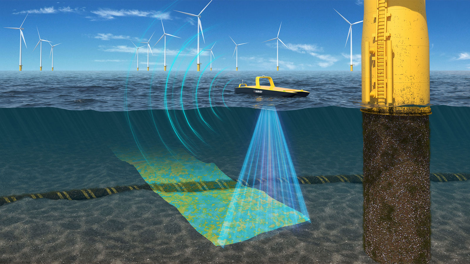
In offshore surveys, time really is money. Vessel operation costs can easily exceed tens of thousands of euros per day. Yet many offshore survey projects still rely on outdated, manual planning methods—often involving spreadsheets, rudimentary maps, and a fair bit of guesswork. These traditional workflows typically take anywhere from half a day to five full days per project just to create a line plan and get the survey parameters for the bidding or survey execution phase.
Even worse, this manual approach introduces risk:
All of this adds up to missed deadlines, blown budgets, and compromised data quality—especially when working with sensor arrays such as multibeam sonar, sub-bottom profilers, or magnetometers in complex bathymetric environments.
TrackPlanner is a next generation planning tool purpose built for the offshore industry. Whether you're conducting surveys with autonomous surface/underwater vehicles (ASVs, AUVs), remotely operated vehicles (ROVs), or traditional crewed vessels, TrackPlanner helps you plan smarter, faster, and more accurately.
Key Features
TrackPlanner also estimates total survey distance, time, number of turns, and expected data volumes — enabling you to plan operations down to the minute.

For surveyors, project managers, and offshore developers, TrackPlanner delivers measurable value:
Efficiency Gains
Cut planning time from days to under 1 hour. Focus more on execution, less on prep.
Improved Bids and Project Control
Submit more accurate bids with confidence. Precise planning boosts your chances of winning contracts—and staying within budget once operations begin.
Reduced Operational Risk
By incorporating terrain and sensor-specific parameters, you reduce overlap, minimize data gaps, and ensure the required data quality.
Repeatability & Standardization
Reuse and adapt plans across projects. TrackPlanner’s structured outputs and templates support better knowledge transfer and QA/QC.
With every project planned using TrackPlanner, you get:
Whether you're preparing for a UXO survey, a cable route investigation, or an environmental baseline assessment—TrackPlanner is your reliable copilot.
.jpg?width=1600&height=900&name=featured-image%20(1).jpg)
In the high-stakes world of offshore surveys, smarter line planning isn’t a luxury—it’s a necessity. TrackPlanner brings automation, precision, and speed to a process that’s overdue for innovation.
If you want to learn more or see TrackPlanner in action, feel free to reach out:
3 min read
Imagine this: our oceans are not just inert bodies of water; they function as the very “lungs of our planet”. Did you ever stop to think that...

Berlin /Kiel 16.10.2023 Last week north.io exhibited at INTERGEO 2023, the world's leading exhibition and conference for geodesy, geoinformation,...

We’re excited to announce our latest innovative feature on all north.io data platforms: Geotagging.

In the fast-paced world of offshore energy, "the need for cost efficiency, increasing time pressure and the availability of experts is what keeps...