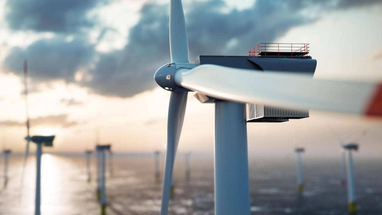
In the ever-evolving world of marine operations, efficient data management and analysis are essential for success. TrueOcean enables these opportunities with a new holistic generation of cloud-based ocean data systems that goes beyond GIS-systems and rethinks the way we handle and leverage marine big geospatial data in the offshore domain. With its comprehensive suite of features and specialized functionalities, TrueOcean offers a robust solution for data transfer, inspection, analysis, and integration, empowering professionals in the field to unlock valuable insights and make informed decisions.
The main aspects of the TrueOcean platform technology are:
Effortless Data Transfer and Inspection
TrueOcean simplifies data transfer by providing seamless connectivity between the field and the cloud. Whether you are working on-site or remotely, TrueOcean ensures efficient and reliable transfer of data, enabling quick and convenient data inspection from any location and at any time. With a user-controlled creation of an unlimited number of upload channels for SFTP, rsync and tusd protocols, this flexibility and accessibility streamlines workflows, improves collaboration and facilitates near real-time data access. In the future, these flexible data transfer implementations will be used to stream data directly from ship-based or autonomous systems to the cloud, enabling new levels of efficiency in project management, data control and inspection.
Vendor-Independent and Cloud-Powered
TrueOcean offers true vendor-independence, providing the flexibility to operate across various platforms and environments. Leveraging the power of modern cloud technologies like Amazon AWS, Google Cloud, Microsoft Azure and Ionos. TrueOcean is designed to run on public cloud platforms and large corporate data centers worldwide. This versatility ensures optimal performance, scalability, and reliability, regardless of the operational context or legal restrictions. The technological basis for all our developments is the Kubernetes platform, also known as K8s, designed on the principles to run billions of containers/microservices in parallel. Our advanced cloud-native implementation allows scaling of our applications no matter how complex our customers' needs are.
Scalable Processing Capabilities for Marine Big Data
TrueOcean's power lies in its ability to process and analyse massive data sets with high scalability and efficiency. Leveraging scalable cloud resources, TrueOcean employs a novel approach to advanced processing on marine big data sets. This enables seamless analysis of entire datasets in the petabyte range, facilitating in-depth exploration and uncovering valuable insights that were previously hardly achievable. Our technological foundation is built on powerful programming languages such as Rust, Java and Golang, as well as advanced and tailored integration of some of the world's most widely used Apache Foundation big data technologies such as Spark, Sedona, Parquet and Arrow. All these technologies are brought together using Kubernetes to provide our customers with a seamless user experience.
Tailor-Made Functionalities for the Offshore Domain
TrueOcean sets itself apart by providing highly specialized functionalities tailored for the unique requirements of the Offshore industry. Whether it involves planning, analysing survey results, or managing metadata, TrueOcean offers a comprehensive suite of tools designed to address the distinct challenges and demands of marine operations. What makes it so special is its ability to interact with raw sensor data. The integration of all kinds of raw data formats allows for a completely new type of automated data control, which was previously only possible in a time-consuming and manual way using several software packages at the same time. This tailored approach leads to significant enhancements in efficiency and accuracy, enabling professionals to extract maximum value from their data.
Geospatial Indexing and Integration
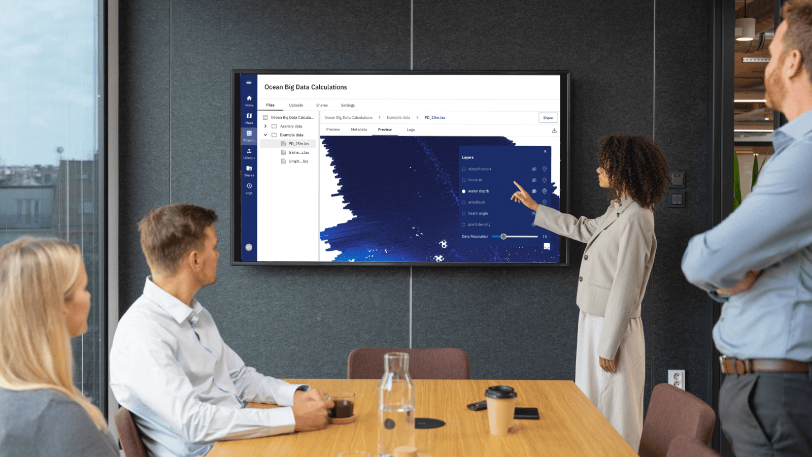
TrueOcean simplifies data management and retrieval by performing geospatial indexing for all supported datasets. This first of its kind cloud-based geospatial indexing system, that goes beyond GIS-systems, keeps a detailed record of the entire dataspace. This makes it effortless to search and locate specific data and sensor coverage areas for regions of interest using different search parameters. The special feature of TrueOcean, in comparison to conventional GIS-systems, is that diverse raw data sets can be read and are automatically indexed. These include a wide variety of data formats from the areas of multibeam (e.g., GSF, RAW, XTF, ALL, S7K, KMALL), side scan sonar (e.g., XTF, JSF, SDF), sub bottom profiler (e.g., SEGY, SEGD), geospatial (e.g., GeoTIFF, Shapefile, XYZ, ASCII, LAS/LAZ, GeoJSON, JPEG, PNG), Computer-Aided Design (e.g., DXF, DWG), Images/Video (e.g., JPEG, MPG, AVI, MOV, MP4) and more. Furthermore, TrueOcean ensures seamless integration with common acquisition software packages, including the QPS suite, ensuring smooth data transfer and compatibility across platforms. In addition, TrueOcean uses a highly efficient cloud-based, and open-source data format (Apache Parquet) for internal data handling and analysis. This enables the users to extract the results at each stage of the analysis to integrate the intermediate results into the user’s internal work processes.
Sensor data and pointcloud-native
Our goal at TrueOcean is to help you make the most of your valuable sensor data. To do this, we are breaking new ground and bringing a new paradigm to the maritime world: data analysis directly at the sensor data and individual point data level. Conventionally, the workflow has been to clean the sensor data, convert it into a raster, and then perform further analysis on these raster datasets. However, the use and generation of raster data always involves a loss of valuable information: gridding is an attempt to find a compromise between point density and cell size, and to reduce the data size. Due to the historical use of limited desktop resources and the limitations of data acquisition equipment, it has not been possible to work on original point clouds on an economic scale. However, beyond GIS-systems, TrueOcean is changing this and can enable analysis directly on point clouds, based on its proprietary sensor data importer and a Big Data pipeline built on top of it. This makes it possible to perform the analysis on the real data and not the interpolated raster data, achieving a higher accuracy in the numerous calculations. Even AI-based detection of objects working directly on the point clouds can provide a significant improvement over the status quo.
Holistic View and Simplicity
TrueOcean provides a holistic view of cloud computing, GIS-systems, big data computing, and marine data. This integration allows for seamless data sharing, comprehensive data analysis, and deep insights into complex marine environments. The challenges in dealing with marine big data are constantly growing due to the limited access to highly skilled experts and the gigantic targets in the offshore area. Simplicity and interoperability are therefore at the forefront of all our developments to enable both experts and non-experts to use our platform technology efficiently. TrueOcean facilitates easy publishing of datasets via OGC-compliant standards (WMS/WFS), enabling deep integration with third-party systems and fostering collaboration among stakeholders.
Operability for Non-Experts
The ongoing usage of our oceans and especially the developments in the field of offshore wind also accelerates the shortfall in human resources and specialists. In response, TrueOcean has tailored its services to focus on digitalisation as an enabler and supporting platform for efficiency gains. By establishing a new way of geospatial technology with user-friendly interfaces and intuitive tools, TrueOcean is making advanced specialist technology accessible to people without extensive geospatial and hydrographic expertise. The simplicity and easy-to-understand nature of its applications act as a crucial aid in an environment where skilled manpower is scarce. This digital support system permits professionals from diverse backgrounds to effortlessly engage with maps and inspect acquired or received data, bridging the gap created by the shortage of skilled personnel and ensuring the continued efficiency and productivity of operations.
TrueOcean represents a groundbreaking advancement in marine big data handling with cloud-based GIS-like technologies for the Offshore industry. With its seamless data transfer, user-friendly interfaces, specialized functionalities, advanced data processing capabilities, and easy integration, TrueOcean empowers professionals to efficiently manage, analyze, and leverage marine big data. By harnessing the power of cloud computing and leveraging modern technologies, TrueOcean sets a new industry standard.
 Admin
Admin