 Admin
Admin

In the fast-paced world of offshore energy, "the need for cost efficiency, increasing time pressure and the availability of experts is what keeps business executives up at night". Addressing these concerns head-on, north.io CEO Jann Wendt underscores the pivotal role of automation and digitisation, championing the development of the TrueOcean cloud technology as a solution to enhance data efficiency. Wendt's insights shed light on the vast untapped potential within the industry, urging the adoption of new technologies such as cloud computing, Big Data, and artificial intelligence.
In this exclusive Q&A with Offshore, Wendt delves into the intricacies of TrueOcean, north.io's native-cloud Ocean Data Platform designed for underwater geodata management, offering a glimpse into its transformative applications for the offshore energy sector.
Offshore: What is the offshore energy sector's need for this type of ocean data platform?
WENDT: Offshore energy faces a complex array of data challenges, ranging from data fragmentation, complex and heterogenous data formats as well as data management issues due to the sheersize and complexity. The dispersed nature of offshore energy data across multiple sources, coupled with inconsistencies in data formats and protocols, hinders the ability to gain a unified understanding of the marine environment and assets. Integrating and analysing the vast and heterogeneous data generated is a complex task.
Traditional data integration tools often lack the scalability and sophistication to handle the volume, complexity and velocity of this data.
Added to this, the offshore industry needs to focus on efficiency to achieve economies of scale and reduce costs, ensuring competitiveness. Standardising processes across projects enhances consistency and operational reliability. Therefore, integrating new technologies demands a process-oriented approach for continuous improvement and industrywide best practices.
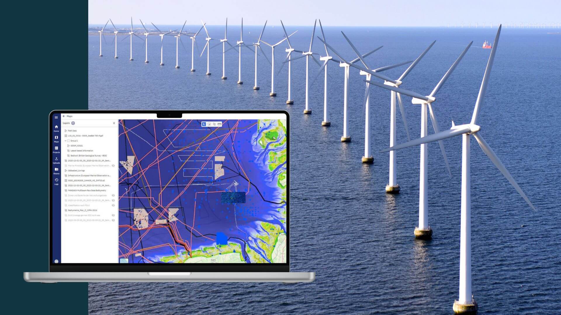
TrueOcean provides a single repository for consolidating and managing all relevant marine data, ensuring data consistency and ease of access. This centralised approach eliminates the problem of data fragmentation and facilitates comprehensive data management.
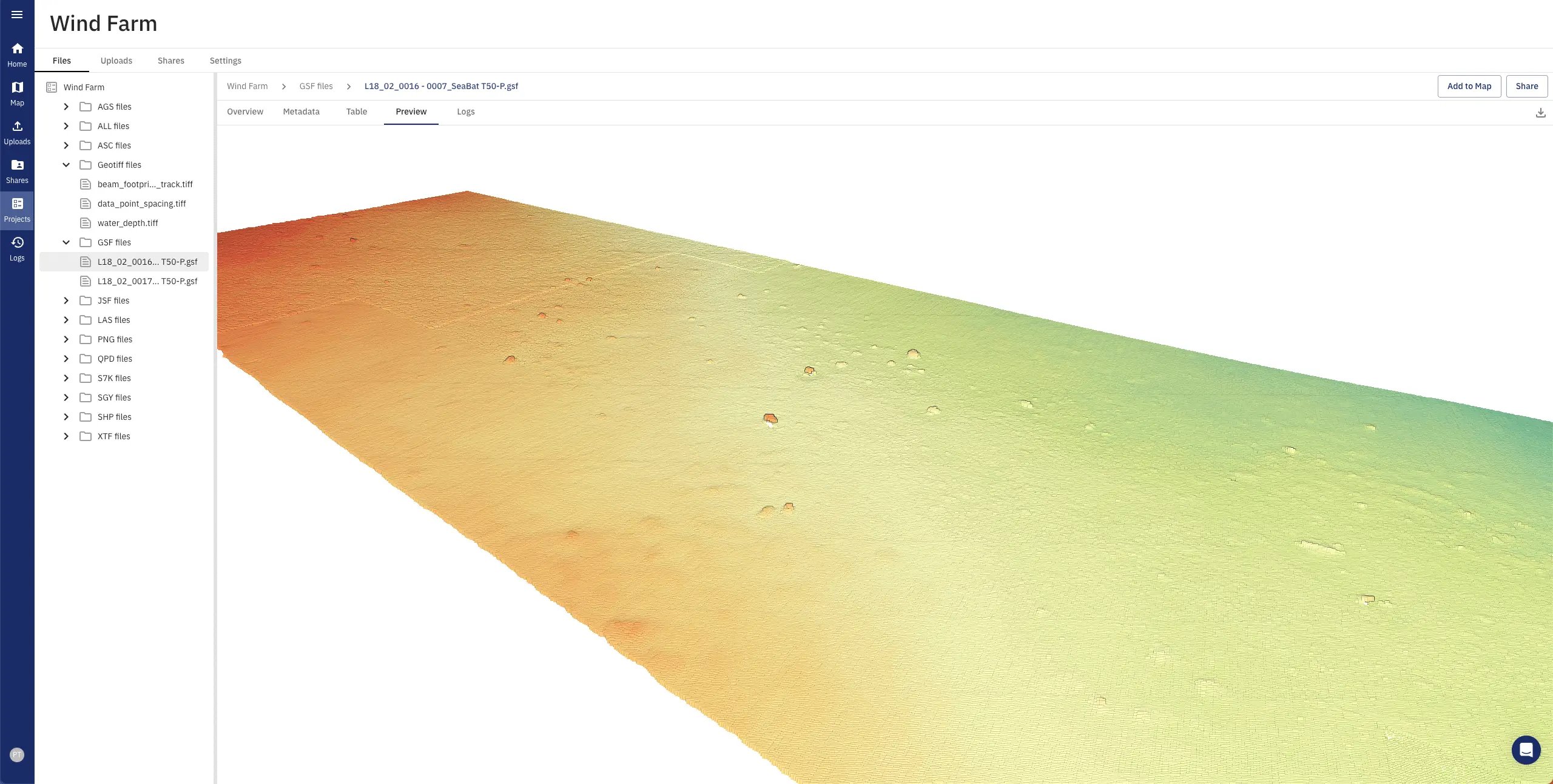
TrueOcean offers 2D and 3D rich visualisations, enabling users to comprehend complex data through intuitive representations.
In particular, the ability to search petabytes of data across the world in different projects by simply drawing a search box on the map, even for complex spatial data formats such as multibeam, side scan, and subbottom profiler, is something that no other software currently offers. Developing and integrating our own cloud-based data reader technology allows the handling of complex binary data formats, which usually need to be handled by many specific desktop applications. The developed technologies are the foundation of the digital transformation of an entire domain.
Offshore: How did the company develop the geospatial technology?
WENDT: TrueOcean's geospatial data technology has been developed over the last three years by over 65 software and research engineers based on lessons learned from more than 13 years of cloud and geospatial expertise. The application is designed as a highly scalable microservice architecture with more than 70 individual scalable services powered by the powerful orchestration framework Kubernetes.
Two of the most important design decisions were neutrality and security; we designed the application to be completely cloud-agnostic, meaning that we are not tied to any cloud providers. This allows us to deploy our application in public, private and hybrid environments and, with full isolation, immediately address the key security concerns of the enterprises' IT departments.
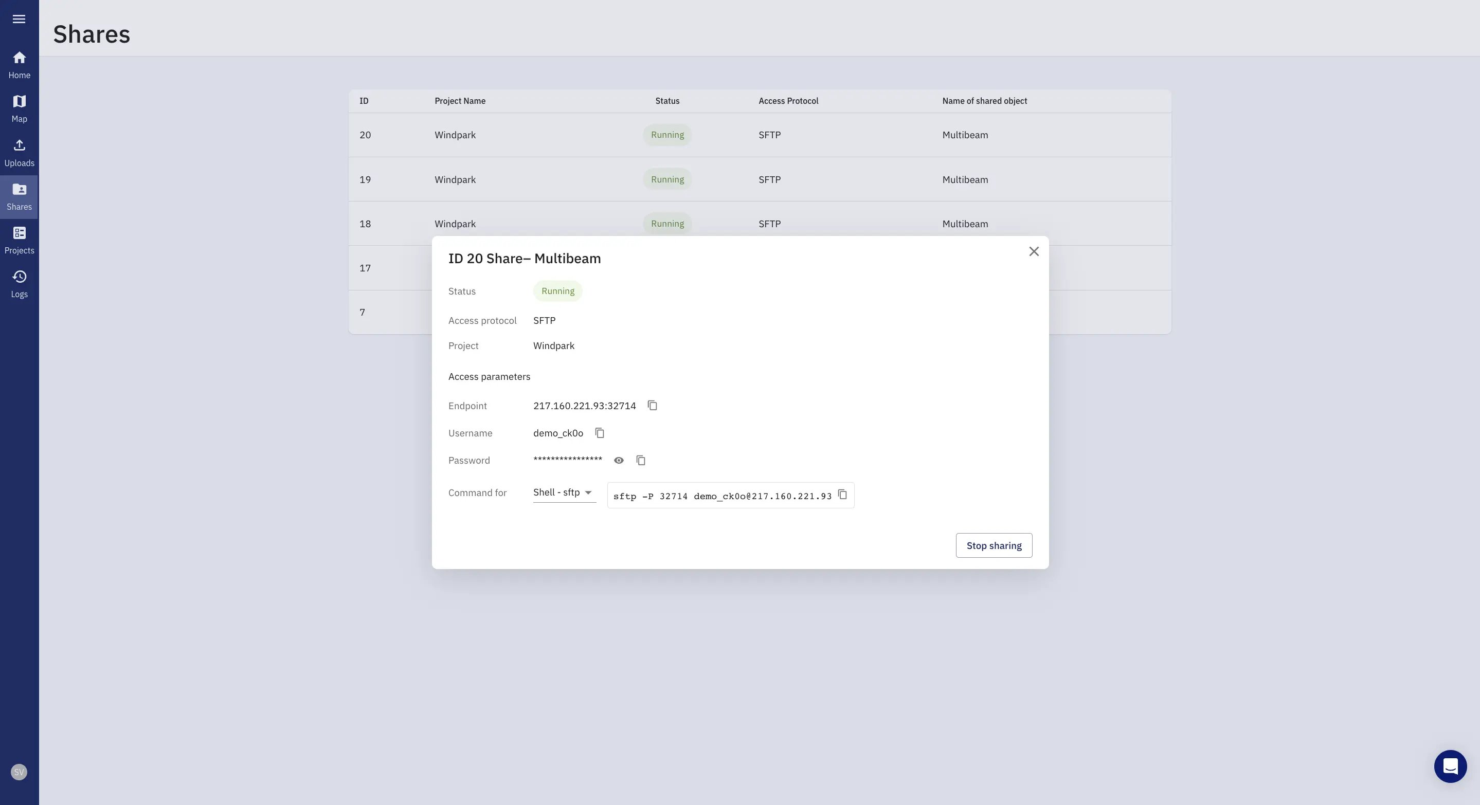 TrueOcean prioritizes the secure storage and protection of data, while facilitating seamless collaboration and data sharing among project stakeholders.
The technology was designed to handle a wide range of data formats and types, originating from different sensor types and survey purposes. This includes data from hydroacoustic measurements, satellites, computer-aided design workflows and geospatial sources, which are common in large offshore infrastructure projects. Therefore, a brand new and cloud-native binary and geospatial data reader technology was developed based on the most modern and programming languages Golang and Rust for highest efficiency and scalability.
In addition, we utilise Big Data ready formats, which are optimised for cloud applications and enable efficient data management and cooperation. The platform, for example, operates internally with Apache Parquet and Apache Arrow, data formats that are column-based and very advantageous for complex and large data handling and processing. Parquet's combination of efficiency, wide compatibility and continuous enhancements make it extremely suitable for cloud data storage and marine Big Data management. By transforming internally heterogeneous marine data formats into standardised and highly efficient columnar approaches, we can apply a wide range of advanced Big Data capabilities at scale.
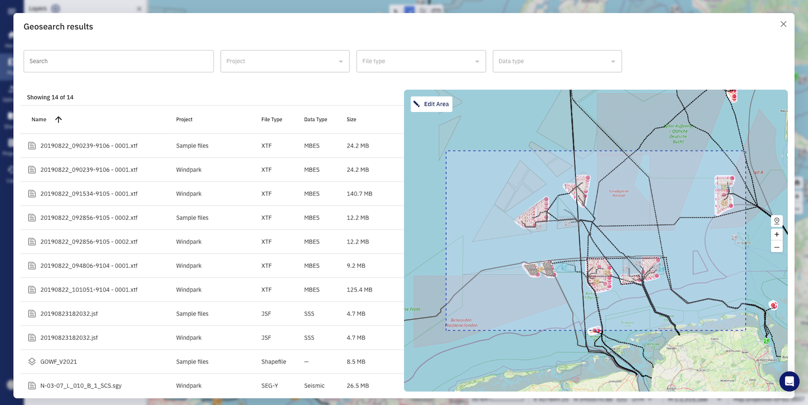 The geospatial search feature is live on the TrueOcean Data Platform.
Another significant technological development is the introduction of geospatial search functionality. The development of new algorithmic approaches to data reduction and spatial data intersection, combined with a high-performance architecture, enables users to quickly locate and access data in petabyte-scale environments with the simplicity of a map-based search.
Offshore: What are the tool's capabilities and offshore applications?
WENDT: Implementing intelligent data management, standardisation and collaboration solutions is the building block for a future-ready data value chain in offshore applications. Especially in the offshore industry, where large-scale underwater projects are characterised by intricate engineering challenges, environmental impacts and multi-faceted stakeholder involvement, the role of data management and standardisation is of the highest importance. Given the sheer volume and variety of data generated, from hydrographic, geological, metocean and other monitoring technology, having a cohesive system for organising and interpreting this information is paramount.
The TrueOcean technology facilitates the collaborative nature of offshore ventures, which typically includes a mix of contractors, regulatory bodies and local authorities, necessitates a unified data framework to facilitate clear communication and shared decision-making. The cloud-native TrueOcean platform automatically geospatially indexes and standardises every dataset uploaded, and therefore allows a highly efficient spatial search of datasets never seen before. Having data organised, structured and transformed to cloud-native data formats is the building block for the whole data value chain by using Big Data frameworks and AI analytics. Based on these building blocks, an organization can become part of a Blue Data Economy and create tremendous additional value out of its data.
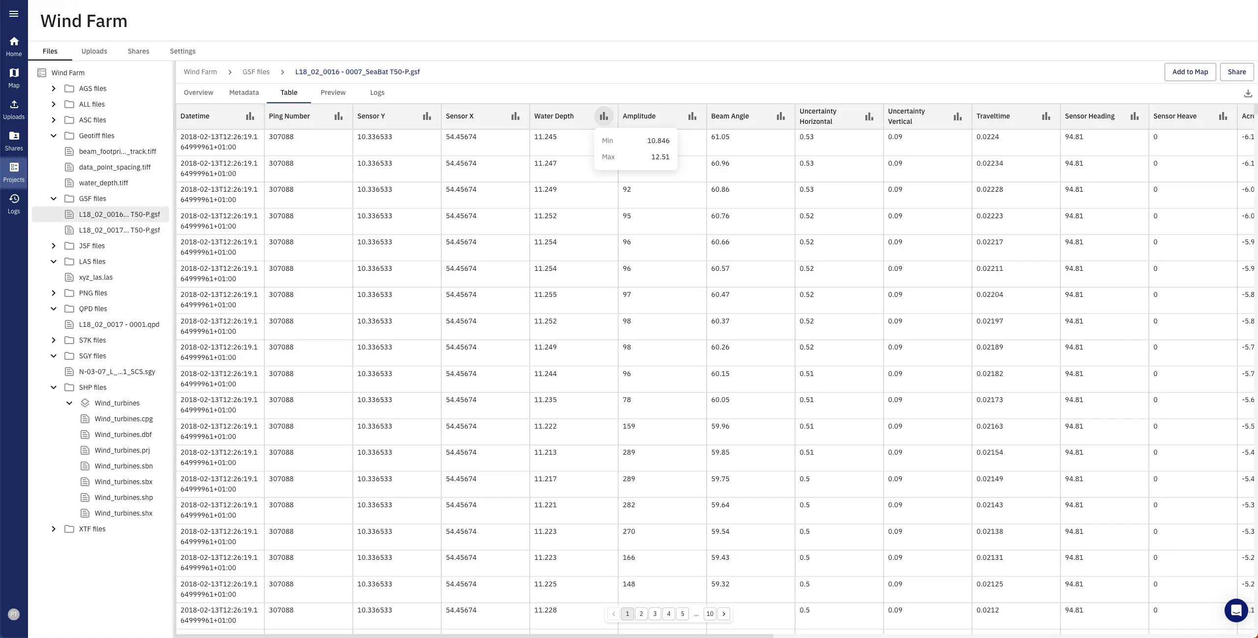 TrueOcean supports a wide range of data files and formats, which can be accessed, visualised, and managed directly on the platform.
Offshore: Can you share any additional work planned to put into development and/or additional energy industry applications the technology might have beyond those defined in its scope of work?
WENDT: The upcoming integration of the in-house developed Big Data technology framework Zeus into the TrueOcean data platform offers several exciting prospects for future developments and applications in the energy industry.
With Zeus, we will introduce a new paradigm for working with marine data: the point cloud way. While today’s approaches are converting (e.g., multibeam) data for quality control and analytical approaches immediately into gridded raster data, we are harnessing the abilities of cloud technology and algorithmic optimizations to perform processing on the highest resolution possible, the point cloud.
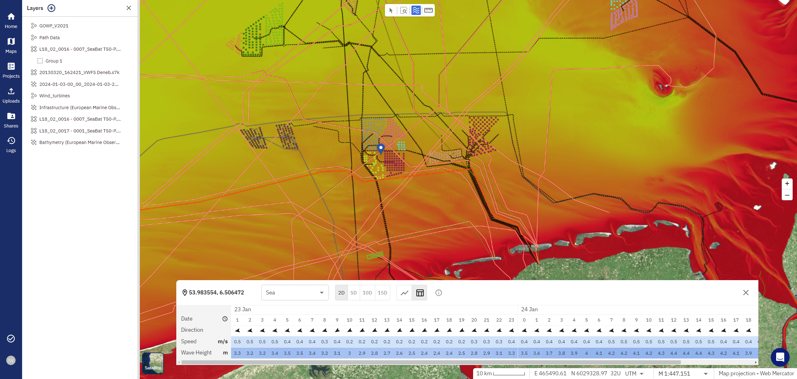 TrueOcean's weather insights and forecasts are natively integrated, enabling professionals to improve data quality control.
Behind the doors, Zeus' uses highly adapted Big Data technologies like Apache Spark/Sedona and Apache Parquet for data storing and processing. This allows us to not only work on the highest possible resolution and receive incredibly detailed results but also to combine single file-based measurements and treat them as one large dataset of an entire area in the tera- or even petabyte range.
Data quality such as data point spacing, horizontal and vertical resolution, motion and many more can be assessed on an individual ping base in hours, rather than weeks or months. And the ability to monitor infrastructure by performing point cloud-based change detection over large areas is simply breathtaking.
Applying this kind of advanced analytics and AI will enable sophisticated data analysis that will massively speed up processes, reduce costs and provide the highest levels of confidence at unprecedented levels. We are already working with our technology partner NVIDIA to take it to the next level by integrating the massive parallelization power of GPUs [graphic processing units] into our processing technology.
We are confident that the scalability of Zeus and the paradigm shift from working on a single ping or point cloud basis will revolutionize the way the entire industry works with large amounts of underwater data and will have a huge impact on the energy industry and the way data analysis is carried out in the field.
Learn more about how AI and Accelerated Computing will transform ocean data processing in our latest blue paper "Zeus: The Future of Geospatial Big Data Processing".
Read the original article published by Offshore: https://www.offshore-mag.com/business-briefs/equipment-engineering/article/14304716/new-geospatial-technology-organizes-interprets-marine-big-data?
One Ocean Data Platform for the Whole Lifecycle of a Wind Farm
Introduction Wind farm projects, often stretching over 60, 100, and more square kilometers in ocean areas, are designed for 30 years of operations....
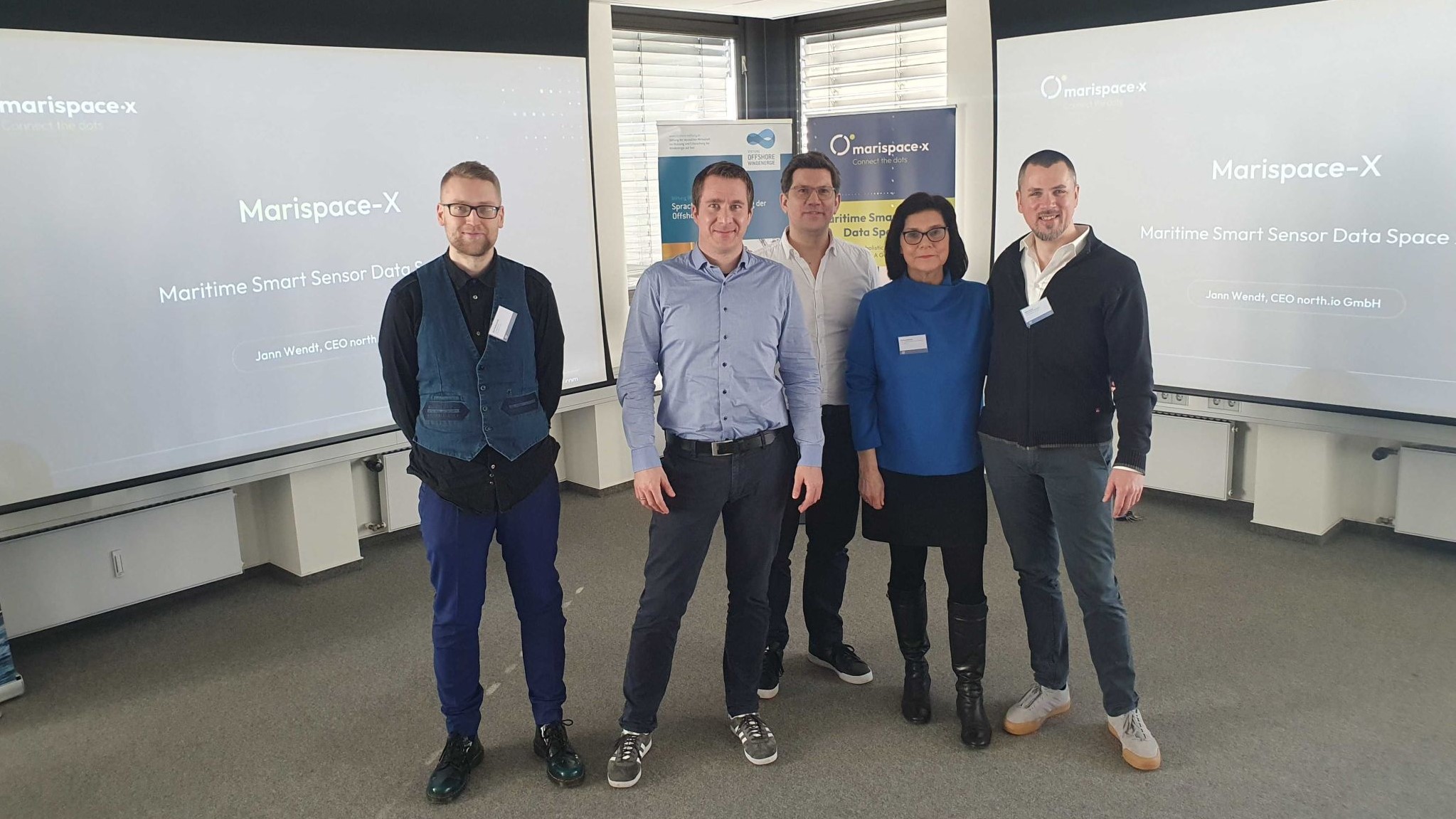
Tackling Challenges at the Offshore-Wind-Workshop with Marispace-X
Launch of the Offshore Wind Workshop hosted by Marispace-X in collaboration with the OFFSHORE-WINDENERGIE Foundation and GMT - German Association for...

How a Marine Data Platform Eliminates Waste in Offshore Data Workflows
1. Eliminating Waiting Times Waiting is a significant source of waste in data workflows. Traditionally, data delivery using physical hard drives has...