2 min read

How to Easily Analyse and Visualise Marine Sensor Data in the Cloud

How to Easily Analyse and Visualise Marine Sensor Data in the Cloud

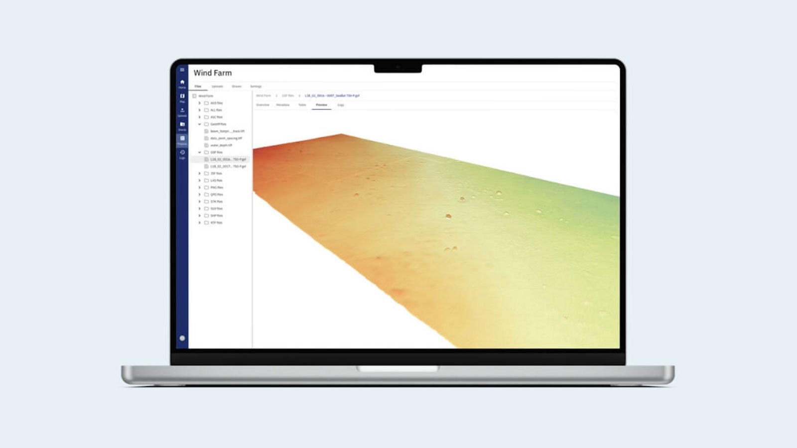
Marine professionals e.g., geophysicists, geotechnical engineers, metocean engineers, and researchers face an array of challenges when it comes to managing and working with marine sensor data. The unique characteristics of the underwater environment, coupled with the diverse range of marine data formats, can make data analysis and integration a daunting task. Fortunately, TrueOcean, a cutting-edge marine data platform, rises to the challenge, providing marine scientists with a comprehensive solution for investigating, analysing, and optimising their valuable data.

Understanding the Challenges

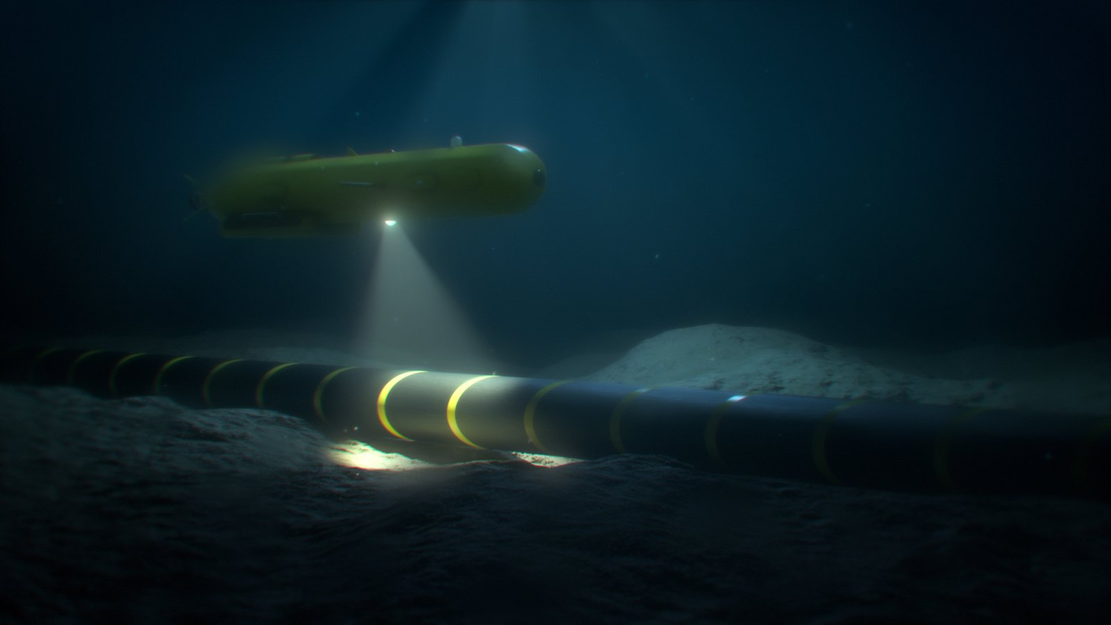
The complexities of marine sensor data management have long been a hurdle for marine scientists. Some of the key challenges they encounter include data format diversity, lack of standardization, large data volumes, data quality assurance, and metadata management. Additionally, synchronising timestamps, data preprocessing, compatibility with analysis tools, long-term data archiving, data security, and real-time processing pose formidable obstacles to effective data utilisation.

The Solution: Analyse and Visualise Data with TrueOcean

TrueOcean presents a game-changing solution that empowers marine professionals to unlock the true potential of their marine sensor data. The cloud platform offers an impressive array of features designed to easily analyse and visualise marine sensor data:

  • Geolocation on the Map: TrueOcean allows users to visualise files with geocoordinates on a zoomable map. For instance, multibeam files are presented as tracks with directional arrows, providing a clear overview of the data.
  • Metadata and Logs: Scientists can easily preview the metadata and logs of their uploaded files on the Overview screen. This quick access to critical information enhances data comprehension and analysis.
  • Content Table View: Some file types can be displayed in a tabular format, enabling users to explore the data in a structured manner. Activating the "Preview" feature allows for seamless navigation through large datasets. 
  • Preview: For specific file types, such as multi-beam files with 3D point cloud views, the "Preview" feature offers visual displays that aid in data interpretation and analysis. 
  • Display on the Main Map: By selecting the "Add to map" option, users can showcase their geolocation-enabled files on the main map, facilitating comparisons and spatial analysis. 
  • File Context Menu: TrueOcean simplifies file management through its intuitive context menu. Users can change file types, group similar files, share data, download files, delete files, and even reindex files if needed.
TrueOcean MDP - Metadata
TrueOcean MDP - Seismic Preview
Table View - TrueOcean MDP
Geotiff file - TrueOcean MDP
TrueOcean MDP - Point Cloud Preview


Benefits of using TrueOcean MDP

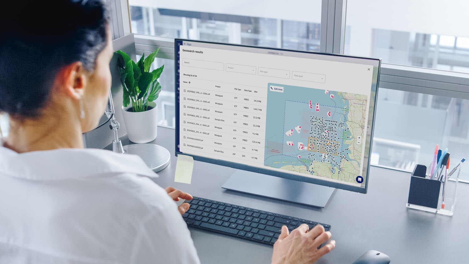
By harnessing the power of the TrueOcean Marine Data Platform, marine scientists and professionals gain access to numerous benefits:

  1. Enables Information Comprehension: TrueOcean empowers both experts and non-experts to comprehend complex data, reducing the risk of knowledge loss and enabling informed decisions across all stakeholders.
  1. Informed Decision-Making and Risk Mitigation: With streamlined data access, analysis, and visualisation, TrueOcean ensures better data quality control, leading to informed decision-making and effective risk mitigation strategies, ultimately enhancing project outcomes.
  1. Enhanced Project Efficiency and Cost Reduction: Through the digitalisation of data processes, TrueOcean automates various steps, saving valuable resources and eliminating inefficiencies. This leads to improved project efficiency and cost reduction.
  1. Secure Data Storage and Protection: TrueOcean prioritises the secure storage and protection of valuable data, safeguarding investments and preserving a competitive advantage, particularly in critical projects like offshore wind ventures.

Conclusion

TrueOcean serves as a powerful ally for marine professionals, offering solutions to the challenges they face while working with marine sensor data. By providing a comprehensive set of features for data analysis, visualisation, and management, the cloud platform empowers marine professionals to leverage their data effectively, unlocking valuable insights and driving innovation in marine research and exploration. With TrueOcean, the vast potential of marine sensor data is finally within reach.


You might also like

Three Big Data Problems of the Marine Sector and Their Solution

4 min read

Three Big Data Problems of the Marine Sector and Their Solution

The marine industry is facing an unprecedented decade: digital technologies promise progress in the development of offshore wind power and the...

Navigating the Blue Economy with TrueOcean to fight climate change

4 min read

Navigating the Blue Economy with TrueOcean to fight climate change

Imagine this: our oceans are not just inert bodies of water; they function as the very “lungs of our planet”. Did you ever stop to think that...

How a Marine Data Platform Eliminates Waste in Offshore Data Workflows

2 min read

How a Marine Data Platform Eliminates Waste in Offshore Data Workflows

1. Eliminating Waiting Times Waiting is a significant source of waste in data workflows. Traditionally, data delivery using physical hard drives has...

Offshore 2.0

11 min read

Offshore 2.0

The German government could not have chosen a more appropriate date for the resurrection of the energy transition. On Maundy Thursday 2022, the...