This year’s edition of the HYDRO conference in Liverpool brought together the best of both worlds: insightful conference sessions and live demonstrations. The event highlighted new innovations and trends in hydrographic surveying, data management, and processing. From automating essential quality control and assurance of subsea data to advancing high-resolution hydrographic data processing, the conference hosted by the Hydrographic Society UK & Ireland (THS:UKI) gathered hydrographic experts to share new ideas on how to optimize working with ocean data.
Turning a live demo into a real-world discovery
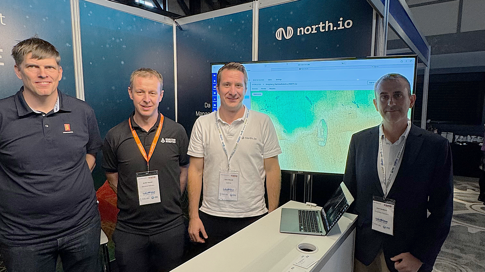
During HYDRO2025 in Liverpool, a routine demonstration unexpectedly turned into a discovery. While showcasing their ocean survey and data capabilities, Maritime Robotics, Kongsberg Discovery, and north.io identified an unknown shipwreck right next to the conference venue (the rum warehouse of the Titanic Hotel in Liverpool). In the first days of the event, Maritime Robotics exhibited their robust uncrewed surface vessel (USV) Otter, equipped with a Kongsberg EM2042 multibeam echosounder, by autonomously surveying the historic Stanley Dock using its Autonomous Navigation System. Within the first minutes of surveying the area (7,650 sqm), the operators were surprised to find a large object on the dock bed. The sensor and survey experts quickly realised they had found a shipwreck. The collected survey data (.kmall) were promptly shared with the north.io team, who generated a fast visual preview of the subsea data.
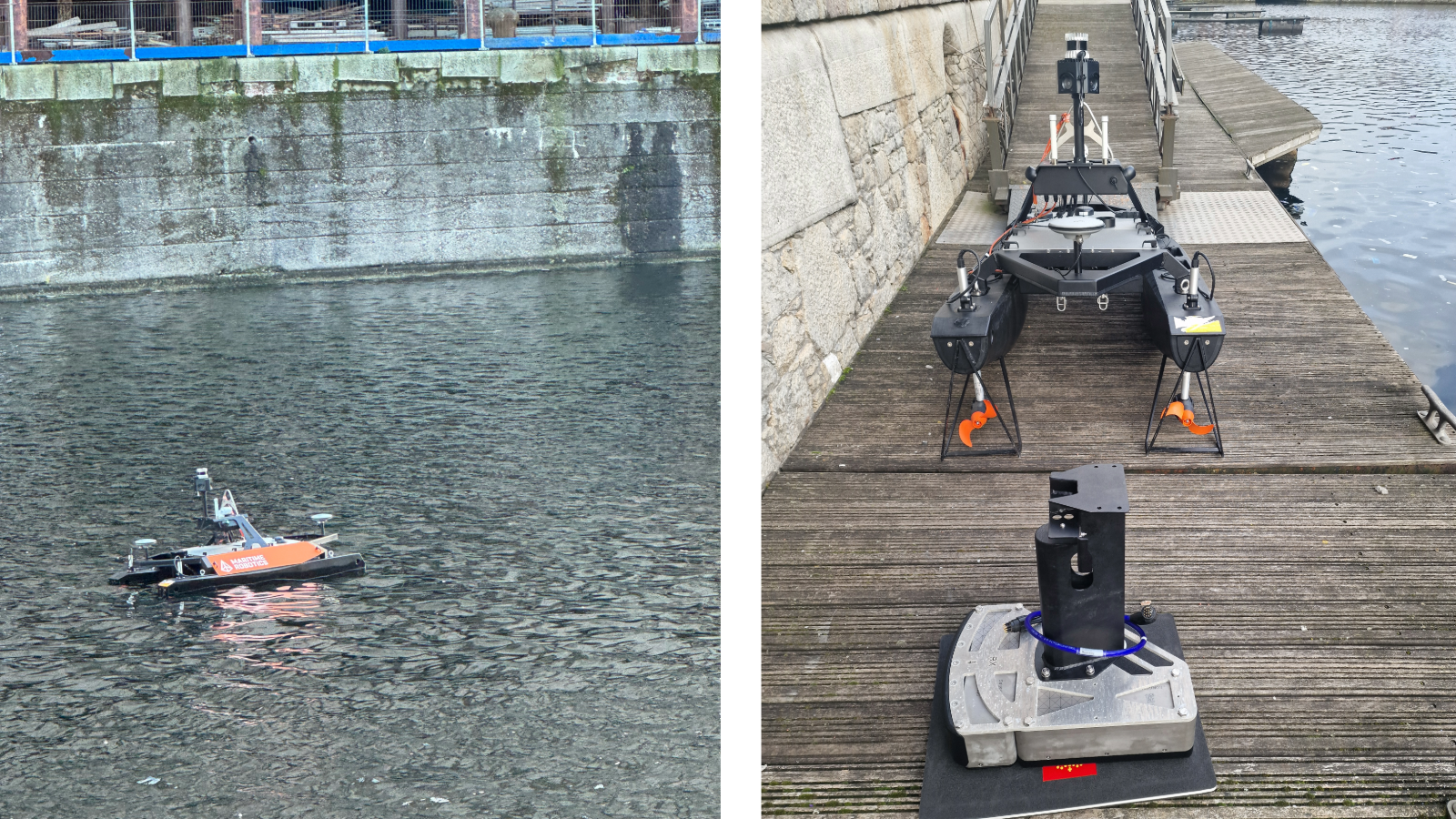
(Left: The Maritime Robotics Otter: USV is 2000mm x 1080mm x 1065mm with a 30kg payload. The survey was done with the precise and light-weight Kongsberg EM2042 multibeam echosounder at 400 kHz. Right: Kongsberg EM2042 multibeam echosounder before being equipped to Maritime Robotics Otter USV. Picture courtesy of Kongsberg Discovery.)
Getting the full picture of the Stanley Dock Wreck
Our data specialists imported the data into north.io’s Ocean Data Platform and directly processed the sensor data using the Ocean Data Processing Engine, which north.io CEO Jann Wendt presented at this year’s conference. The raw sensor data was scanned, converted into a precise point cloud, and rasterized in under 30 minutes. This processed point cloud included more than 118 million individual data points. With this high-resolution 3D point cloud imagery, the full extent of the discovered wreck became clear. The wreck is located in front of the eastern side of the Titanic Hotel at 53.421684 N, 2.99778 W and has a length of approximately 6.5 m and a width of 2.5 m.
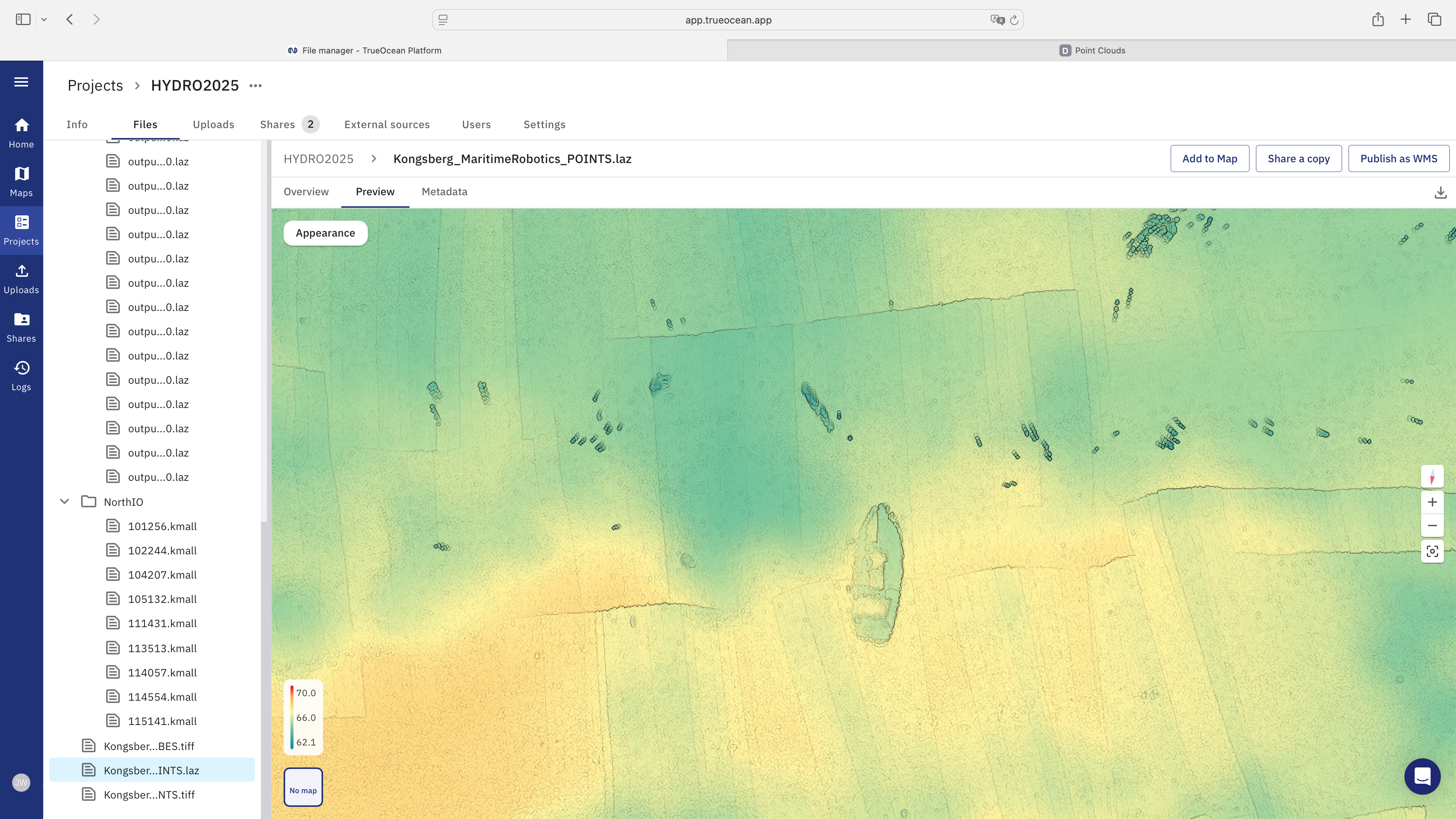
(Data courtesy of Maritime Robotics and Kongsberg Discovery. Visualised on north.io’s Ocean Data Platform.)
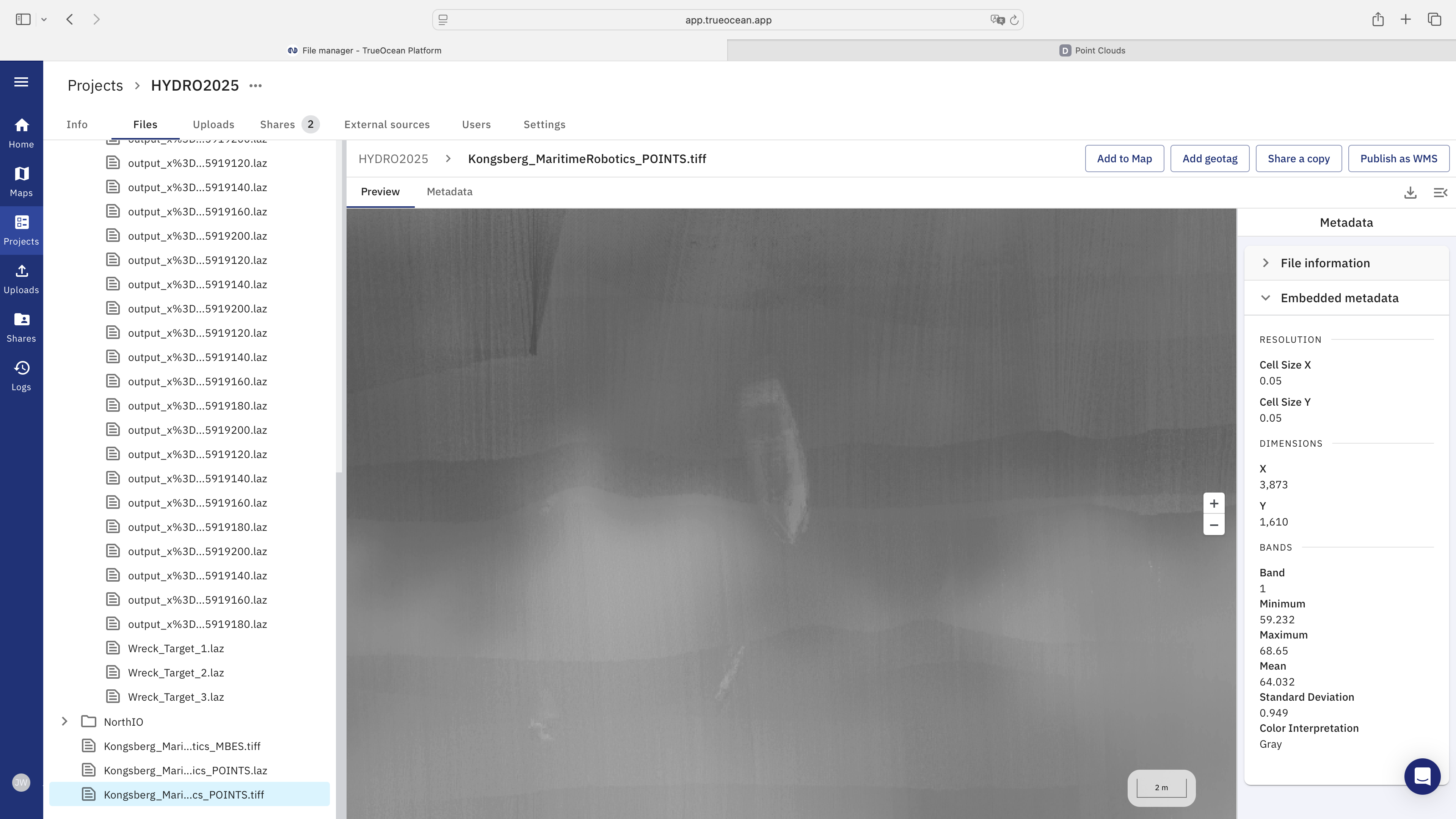
(Data courtesy of Maritime Robotics and Kongsberg Discovery. Visualised on north.io’s Ocean Data Platform.)
Besides the point cloud and raster data, our experts generated 48 point cloud tiles (20m x 20m). As all the data was stored on the Ocean Data Platform, we were able to run a geospatial search to identify all tiles that include the wreck. The search retrieved all data, including the raw Kongsberg sensor data, the processed point cloud data (.laz), and rasterized images (.geotiff).
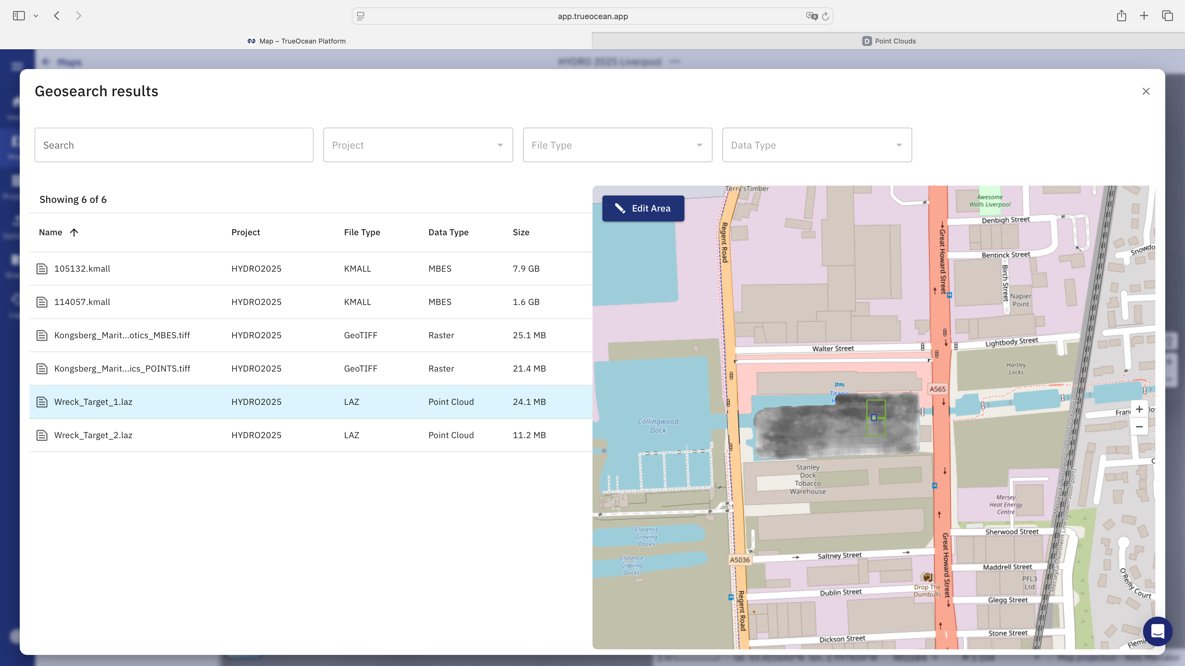
(Results of the geospatial search (GeoSearch) on the Ocean Data Platform showing all files that show the discovered shipwreck.)
This discovery shows vividly how fast ocean big data can be transformed into understandable information. Combining autonomous survey vehicles, high-resolution acoustic sensors, as well as intuitive data management and scalable processing, enabled the teams of Maritime Robotics, Kongsberg Discovery, and north.io to get a full picture of the Stanley Dock within minutes and to show the unknown shipwreck to the excited conference attendees.
About Stanley Dock
The Stanley Dock lies in the Vauxhall area of Liverpool within the northern dock system of the Port of Liverpool. It was opened on August 4th 1848, and used for large volumes of tobacco, rum, and other goods trade. As Liverpool’s dock usage declined throughout the 20th century, the Stanley Dock fell into a period of decline before becoming part of redevelopment plans and being listed as a conservation area. The Stanley Dock is rather unusual for it was constructed inland, rather than extending directly from the river’s foreshore like the neighboring docks, Collingwood Dock and Nelson Dock. A quick research has shown that the are no wrecks documented for the Stanley Dock. The team of Maritime Robotics has passed on the information of this discovery to the local authorities for further investigation.
If you want to learn more about how the wreck was discovered and how new technologies can help streamline ocean big data management and processing, please reach out to our team of Ocean Big Data specialists.
Reach out to schedule a personal discovery call.
.png?width=1600&height=800&name=Unbenannt-13%20(1).png)
 Admin
Admin
.png)
.jpg)