FREE DOWNLOAD TODAY
From Data to Insights:
The Potential of Point Clouds
Information directly from the Point Cloud
During the test phase, the big data processing of the LGV Hamburg data set formed the basis for a wide range of potential use cases. The algorithms developed by north.io enable powerful calculations for point density and spacing, gradient, planarity, sphericity and point cloud rasterisation.
High Flexibility
In addition to data processing and analysis, the development also focused on speed and interoperability. The test environment is based on the cloud-agnostic geodata management platform TrueEarth, which offers users the greatest possible ease of use and flexibility with integrated data visualisation and conversion.
Future Potential
With basic analysis algorithms, TrueEarth can be used to realise a wide range of application scenarios in the future. The most important use cases include point cloud visualisation, spatial statistics, 3D meshing, automated detection of traffic damage, classification, and object recognition.
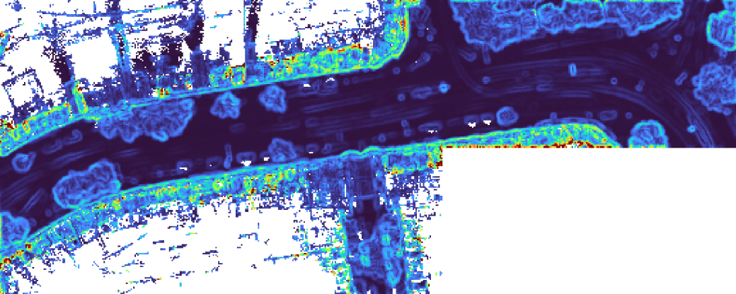
Power from the cloud: scalable big data analyses
Thanks to cloud technology, the calculation of large data sets runs smoothly and quickly. Products of these processes, such as the slope calculation of the point cloud here, can be visualised directly in TrueEarth and thus processed into information.
(Data source: Point cloud data from laser scanning survey, 2023 © FHH, LGV www.geoinfo.hamburg.de)
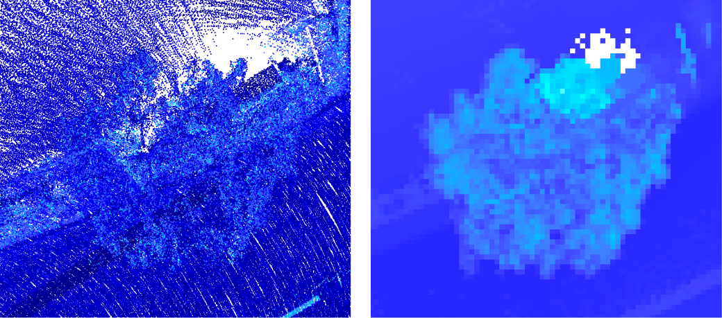
Future-proof modularity
Together with the microservice infrastructure, north.io's big data algorithms provide the basis for further possible applications and extensions directly in TrueEarth. With the help of the point cloud rasterization shown here as an example, trees and other objects can be identified in perspective and insights gained.
(Data source: Point cloud data from laser scanning survey, 2023 © FHH, LGV www.geoinfo.hamburg.de)
What are you waiting for?
Simply enter your details and receive this white paper free of charge.